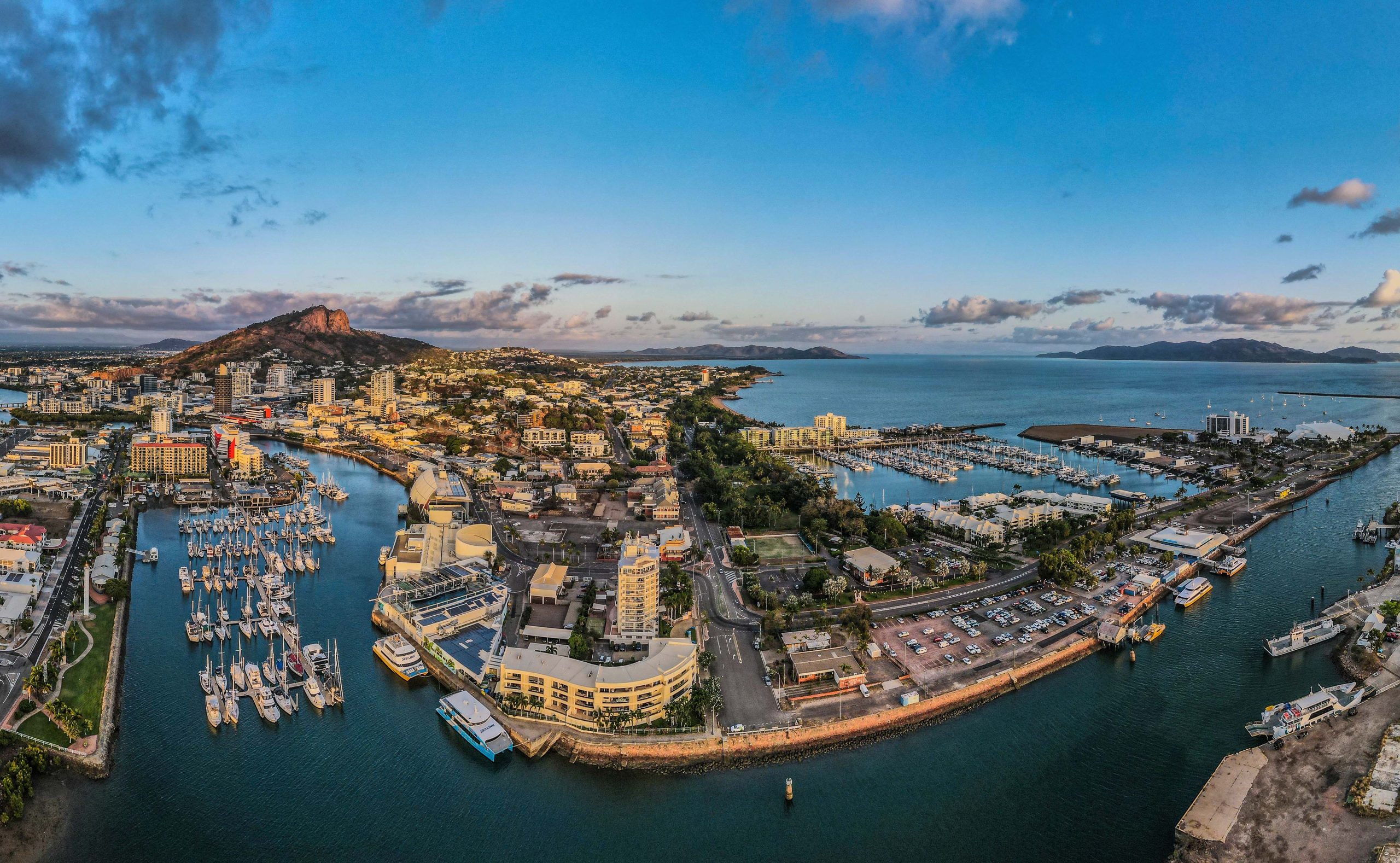
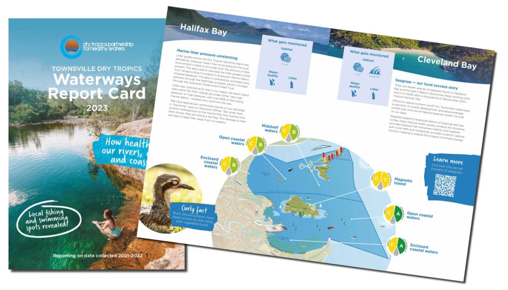
Are Magnetic Island’s mangroves on the move?
“Mangroves are one of this country’s greatest natural assets,” says our Executive Officer, Kara-Mae Coulter-Atkins.
“They’re carbon-hungry machines. They clean our rivers and estuaries. They provide rich habitat and protection for marine and land animals. They protect our coasts from the storm surges and erosion that increasingly threaten our towns.
“And we grow them up here for free. Protecting them is a no-brainer. But to do this, we must first monitor their changes and responses to pressures.”
A popular poster-plant for the value of blue carbon, mangroves are a remarkably responsive and adaptive group.
Satellite imagery analysed by the Digital Earth Australia program revealed significant movement of Australian mangroves over 30 years in response to storm events and climate change. A recent University of Wollongong study found mangrove forests off the Howick Islands in Far North Queensland appear to be expanding.
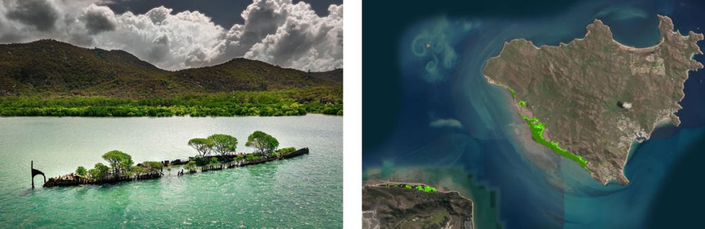
L: Mangroves aboard the SS City of Adelaide wreck, off Magnetic Island’s southern coast. R: Landsat satellite imagery captured in 2022 with Island mangrove forests highlighted by a Digital Earth Australia tool.
But how are the mangrove forests of Magnetic Island (Yunbenun) faring?
Various studies have noted changes in mangrove cover on the Island’s leeward (southern) side, using methods such as early photographs to see comparative cover, but it’s thanks to a citizen science initiative triggered by the Magnetic Island Community Action Plan that changes to these invaluable trees are now being comprehensively recorded.
Getting their muddy groove on
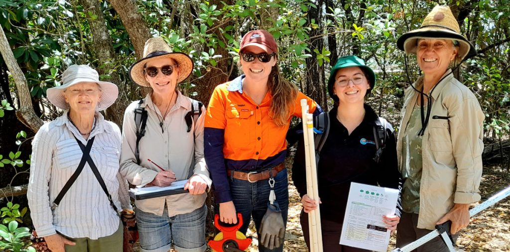
The ‘Maggie Mangroovers’ are a group of dedicated residents conducting regular mangrove monitoring exercises — wading into the mangrove forests that line the island, conducting 25m ‘long plot’ assessments, surveying all trees with a circumference greater than 10cm.
Kara-Mae joined volunteers from the group in a recent monitoring morning, and Islanders Sheree, Kate, and Helen demonstrated to Kara and Brittany Butler from the Port of Townsville the tricks of the groves.
Best practice methods mean standardisation across country
Monitoring methods deployed by the Mangroovers are cutting-edge.
Jock Mackenzie, Earthwatch Wetlands Program Manager and founder of MangroveWatch, trained the Yunbenun volunteers to ensure their data is collected in a standardised way that’s consistent with mangrove data collected around the country — and the world.
Seeing as Australia has more than 11,000km of mangrove-lined coast, it’s an exercise worth getting right.
“On our day out we measured the trees’ girth, recorded whether they were single or multi-stem, looked at their height, and whether they were ‘on the lean’ — leaning one way or another because of erosion or light availability,” Kara says of her morning with the Groovers.
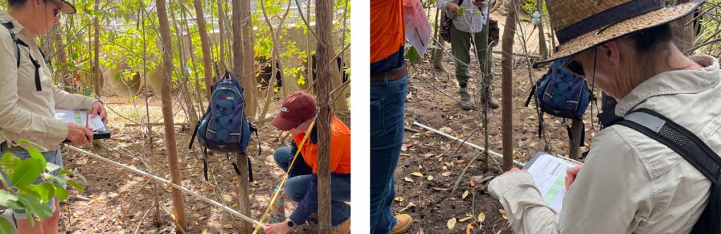
“We documented canopy height and whether the trees were in a multi-layered developing forest or an old forest. Finally, each tree received a 0 to 5 health score, based on number of dead branches, foliage density, canopy cover, and foliage colour.”
The data provides a record of mangrove carbon stocks and forest health that feeds into national monitoring programs such as the Integrated Marine Observing System (IMOS).
Citizen science projects incorporating MangroveWatch methods are being deployed around Australia, and the world. Recently, Jock and the Earthwatch Australia team were in Gladstone, educating teachers and community leaders about the citizen science potential of mangrove monitoring as part of the ‘Protecting Wetlands for the Future’ program. The story was captured in this fabulous video by creative team BenandDi:
Citizen science mangrove monitoring for Townsville too?
“Mangroves are a key player in the health of Townsville’s waterways,” Kara says. “And currently we measure the general mangrove forest cover in our region using satellite imagery.”
The Townsville Dry Tropics Waterways Report Card relies on this imagery to calculate change in waterways habitat extent.
“But the data isn’t regularly ‘ground-truthed’,” she explains. “We have no ongoing comprehensive on-ground data to confirm what we’re seeing from space. We can’t provide deeper insights into the health of the forests, or the canopy height — just that the trees are covering a measurable area.”
 A number of partners within the Dry Tropics Partnership for Healthy Waters have shown an appetite for greater mangrove monitoring in the Townsville region, and we look forward to continuing conversations about this in the coming year.
Until then, congratulations go to the Maggie Mangroovers for putting Maggie’s precious forests on the map for detailed monitoring. The initiative came directly out of the Magnetic Island Community Action Plan (Our World Heritage Island) and received funding support from the partnership between the Australian Government’s Reef Trust and the Great Barrier Reef Foundation.
The Magnetic Island Community Development Association is a leader of the Magnetic Island Community Action Plan, and one of 20 members of the Dry Tropics Partnership for Healthy Waters.
MangroveWatch is a citizen science monitoring program that focuses on the research, education and conservation of mangrove and tidal wetland environments globally. It is delivered by Earthwatch Australia, a global for-purpose organisation dedicated to environmental sustainability and scientific research.